Welcome to Telfair County, GA

Jacksonville | Lumber City | McRae-Helena | Milan | Scotland

Home

About Us

Bd of Director Meetings

Contact Us

Directors & Staff

Telfair County Weather

Attractions/Events

Camera Ready

Chamber Members

Chamber Membership

Chamber Programs

Churches | Telfair Co.

AMC-CME-AME

APOSTOLIC

BAPTIST

CATHOLIC

CHURCH OF CHRIST

CHURCH OF GOD

HOLINESS/PENTECOSTAL

JEHOVAH'S WITNESSES

METHODIST

NON-DENOMINATIONAL

PRESBYTERIAN

Community Information

Airport Authority

American Red Cross

Civic Organizations

Community Brochures

County Extension Services

County/Municipal Govern't

Family/Children Services

GA Family Connection

GA Dept of Driver Service

GA Department of Labor

Georgia DNR

Federal/State Reps

Hospital Authority

Leisure Services

Public Health

Public Safety

Population/Income

Public Library

Regional Commission

Taxes

Telecommunications

Transportation

USDA

Utilities

Veterans Affairs

Weather

Economic Development

Educational Opportunities

Family Connection

Telfair Co Bd of Ed

Athletic Booster Club

Telfair Co High School

Telfair Co Middle School

Telfair Co Elem School

Telfair Co Pre-K

Headstart

Technical College

Employment Opportunities

How To Start A Business

Power Outages Telfair

Publications

Brochures

Newsletter

Pod Casts

Videos

Stay, Dine, Shop

Lodging

Shopping

Dining

Realtor Listings

Ocmulgee River
Ocmulgee River
Telfair County, GA
 
The Ocmulgee River makes up the entire southern boundary of Telfair County.  Along this boundary, the river flows generally in a West to East direction.  This gentle arc forms what is know as the "Big Bend" of the Ocmulgee River.
 
The Worlds Largemouth Bass (1932) was caught from Montgomery Lake, which is an oxbow lake on the Ocmulgee River in Telfair County, GA.  This site is located on the Georgia Department of Natural Resources Horse Creek Wildlife Management Area.
 
For fishing and boating regulations contact the Georgia Department of Natural Resources at (229) 426-5267.

 
Ocmulgee Water Trail Partnership
Planning a trip along the Ocmulgee River?  
CLICK HERE FOR THE OWTP WEBSITE
The Ocmulgee River  is a great destination for paddlers and river enthusiants.
Participating Counties:
Ben Hill | Bibb  |  Bleckley  |  Coffee  |  Dodge  |Houston  |  Jeff Davis  | Pulaski  |  Telfair |  Twiggs  | Wilcox

Ocmulgee River
Telfair County, GA
 
The Ocmulgee River makes up the entire southern boundary of Telfair County.  Along this boundary, the river flows generally in a West to East direction.  This gentle arc forms what is know as the "Big Bend" of the Ocmulgee River.
 
The Worlds Largemouth Bass (1932) was caught from Montgomery Lake, which is an oxbow lake on the Ocmulgee River in Telfair County, GA.  This site is located on the Georgia Department of Natural Resources Horse Creek Wildlife Management Area.
 
For fishing and boating regulations contact the Georgia Department of Natural Resources at (229) 426-5267.

70 mile journey along the southern boundary of Telfair County along the Ocmulgee River provided by Telfair County historian, Guy Bland.
The Ocmulgee River was known as the "River of Bubbling Water"

*Some of the below locations still exist today

Beginning at Dodge County:
1) McCranie's Landing-"The Boatyard": Proceeding downstream there were numerous spring fed creeks on both sides of the river.

2)Mossy Log: An Oxbow lake that was a spring fed creek.

3)Mouth of Spring Lake:  Spring fed creek.

*4)Dodge's Old Lake: Was also known as "Willcox Lake".  John Willcox built poleboats at this location.  Spring fed lake; Dodge Sawmil and Tram road -1886

5) Oscewickee Springs-Spring fed creek.

*6)Big Horse Creek:  "Al-ka-sac-ki-li-ki Creek" which means "Kettle Boiling in Creek"

7)Pilings: Long line of staggered posts constructed to help maintain a deep river channel for steamboat traffic.

8)Telfair Mound: "Indian Mound"

9) Tiger Leap: Highest Bluff estimated at 60 feet.

10): Yellow Bluff: river changed-located on oxbow lake.

11) Boney's Ferry-Public ferry between China Hill and Fitzgerald, tram railroad, steamboat landing.

12)Paramore's Landing-Early pioneer, John Paramore operatd a "public house"-Saloon.

13)Mobley's Bluff (Ben Hill side): Steamboat landing. Captain John Mobley is buried in a family cemetery beside US 319.

14)Red Bluff: Coffee Co. Side.

*15)Barrs Bluff: Coffee County Side with railroad to Broxton.

16)Coffee's Bluff-Pioneer Plantation Owner, General John Coffee operated a steamboat landing here.  He was a road commissioner.  Built a road from Jacksonville to Tallahassee, FL 1822.

17)Sunk Boat: Also known as Steamboat Lake (oxbow).  General Manning-boiler exploded there in 1860 killing 14 people.

*18)Flat Tub Landing:Coffee County side

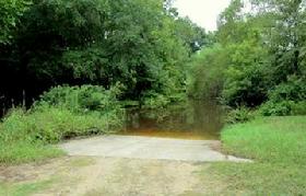
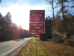
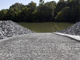
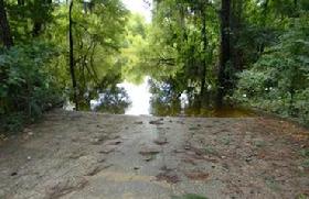
*19)Scuffle Bluff:Telfair Co. Side.  Steamboat Landing. Site of a new boat ramp.

*20)Rocky Hammock: Jeff Davis County side; first rock formations.

21)Telephone Cable: Underwater Bell Telephone line.

*22)Montgomery Lake: Oxbow lake. World Record Largemouth Bass caught here.

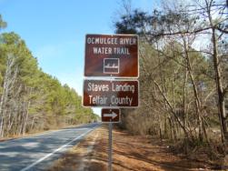
*23)Stave's Landing: Telfair Side; named for Barrell Staves made from green Ash trees.

*24)Horse Creek: lower boundary of Horse Creek WMA>

25)Dodge's Old Boom: Telfair side; 1877; Tram Railroad to the river.  Logs were made into timer rafts and floated to mills in Darien.

*26)Burkett's Ferry Landing: Jeff Davis side; public ferry between Jeff Davis and Telfair Counties.

27)McRae's Landing: Telfair side; site of last timber raft in 1982.

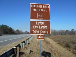
*28)Lumber City Landing: Hwy 341 bridge.

*29)Little Ocmulgee River: Also known by its Indian name "Auchenhatchee River"; forms the eastern boundary of Telfair County.

Dodge's Lake Landing
Concrete ramp; No facilities
Directions from Jacksonville, GA: Travel 12.2 miles North on GA Hwy 117. Turn left on County Road 15 (dirt road). Landing is 2.1 miles


Scuffle Bluff Landing
Concrete; No facilities

Directions:
From Jacksonville, GA:  East on Ga Hwy 117 continuing east approximately 7 miles; entrance to Horse Creek WMA is on the right. Continue on the WMA road approximately 2 miles. Entrance to the boat ramp area will be on the left just before the river.

From Lumber City: West on GA Hwy 117 west approximately 13 miles; entrance to Horse Creek WMA is on the left. Continue on the WMA road approximately 2 miles. Entrance to the boat ramp area will be on the left just before the river.

Latitude: N 31.815850 Longitude: W 82.839347


Staves Landing
Concrete ramp; No facilities
Directions from Jacksonville, GA: Travel 2 miles North on GA Hwy 117. Turn left on County Road 185 (dirt road). Landing is .3 miles

Lumber City Landing
Concrete landing; No facilities
Directions from Lumber City, GA: Travel 1.2 miles South on US Hwy 341. Turn right on landing approach road (paved)

Image: 
Additional landing information and lodging information can be obtained from the 
Telfair County Chamber of Commerce.
Phone: (229) 868-6365
Email: rogers@telfairco.org
 
Emergency #: Dial 911


Telfair County Chamber of Commerce
9 East Oak St. | McRae-Helena, GA 31055
Office (229) 868-6365 | Cell (229) 860-0203
Email: rogers@telfairco.org
Website: www.telfairco.org

Web Hosting powered by Network Solutions®